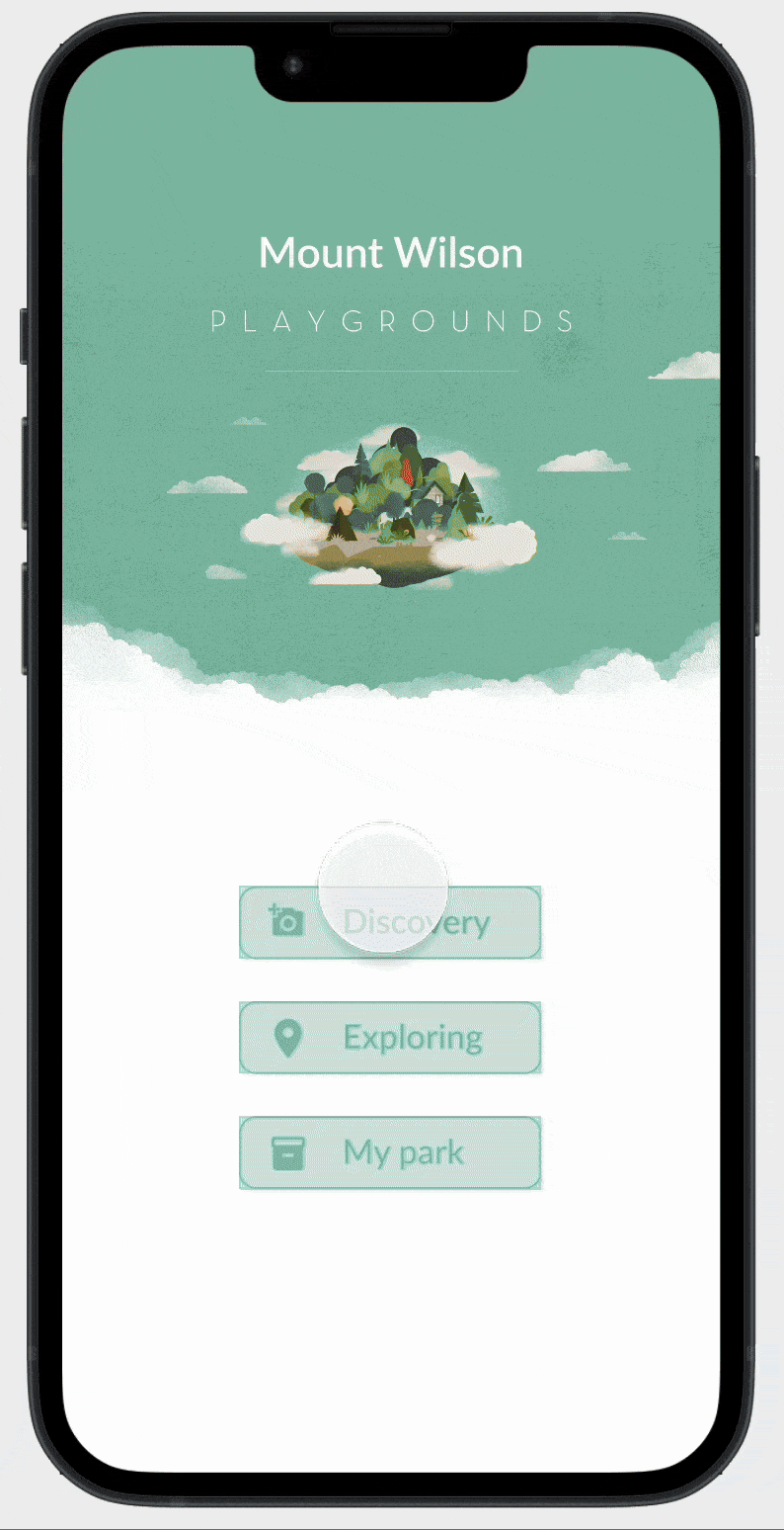
WildGaze
Are we just passing through nature—or becoming part of it?
This project is designed for hikers and wildlife lovers visiting Mount Wilson in LA. Through an interactive experience of scanning, photographing, and observing, users uncover traces of wild animals often missed on the trail.
By blending discovery with gentle education, the design aims to build awareness and empathy—inviting people to explore nature not just with their feet, but with care and curiosity. Wildgaze invites hikers to slow down and rediscover Mt. Wilson’s hidden wildlife—one glance at a time.
Type
Product design,
UX/UI design
Specification
Figma,
Blender
Time
02-4. 2023

Problem
While hiking, nature lovers often spot wild animals—but information about them is scarce, fragmented, or unengaging. Opportunities for learning and connection are lost in the moment.
To create an interactive experience that empowers hikers to recognize, track, and share wildlife encounters in real-time — making animal discovery playful, educational, and social.
Inspiration
Why Wildgaze?
As a hiker, I often felt a disconnect from the wildlife I encountered. Wildgaze bridges that gap — turning curiosity into contribution through an interactive wildlife map.
Problem
Goal
Key Features

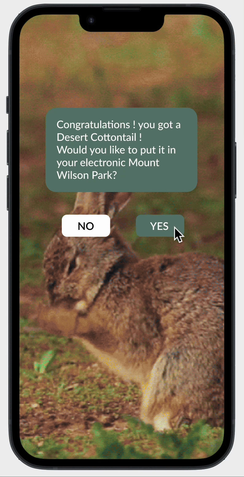
Snap & Identify
Instantly scan and recognize wild animals using user's camera. Get basic info, fun facts, and save the sighting

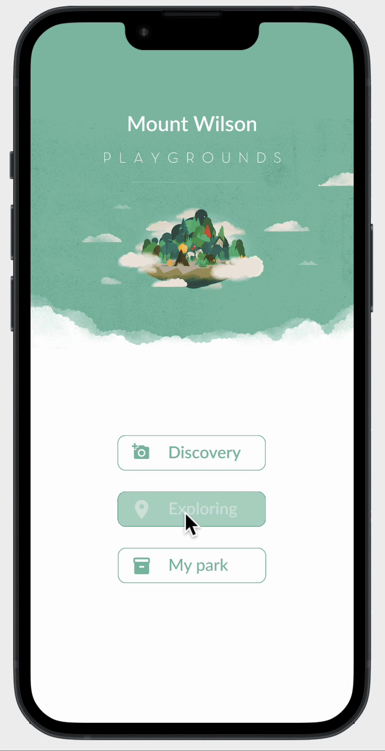
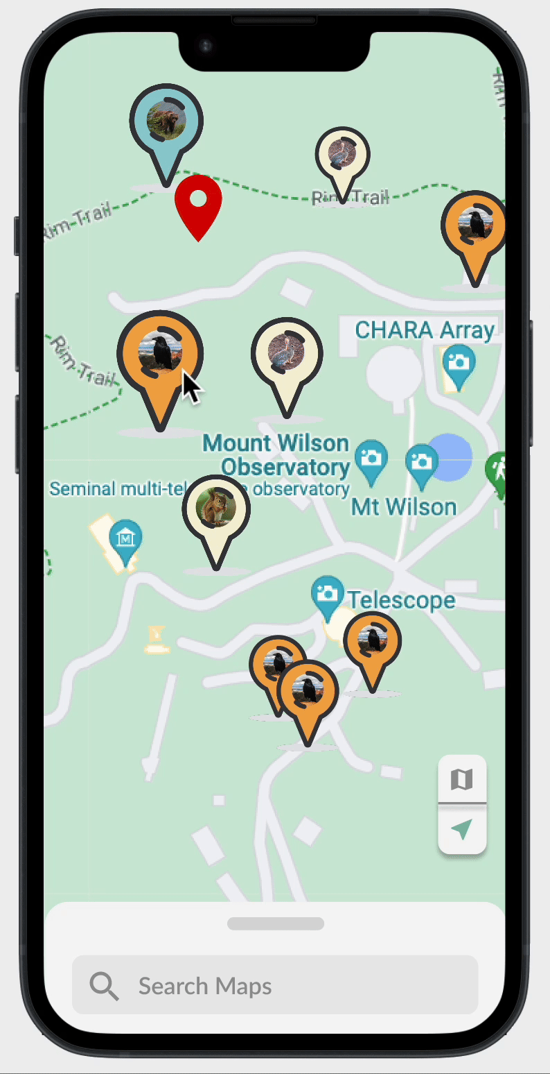
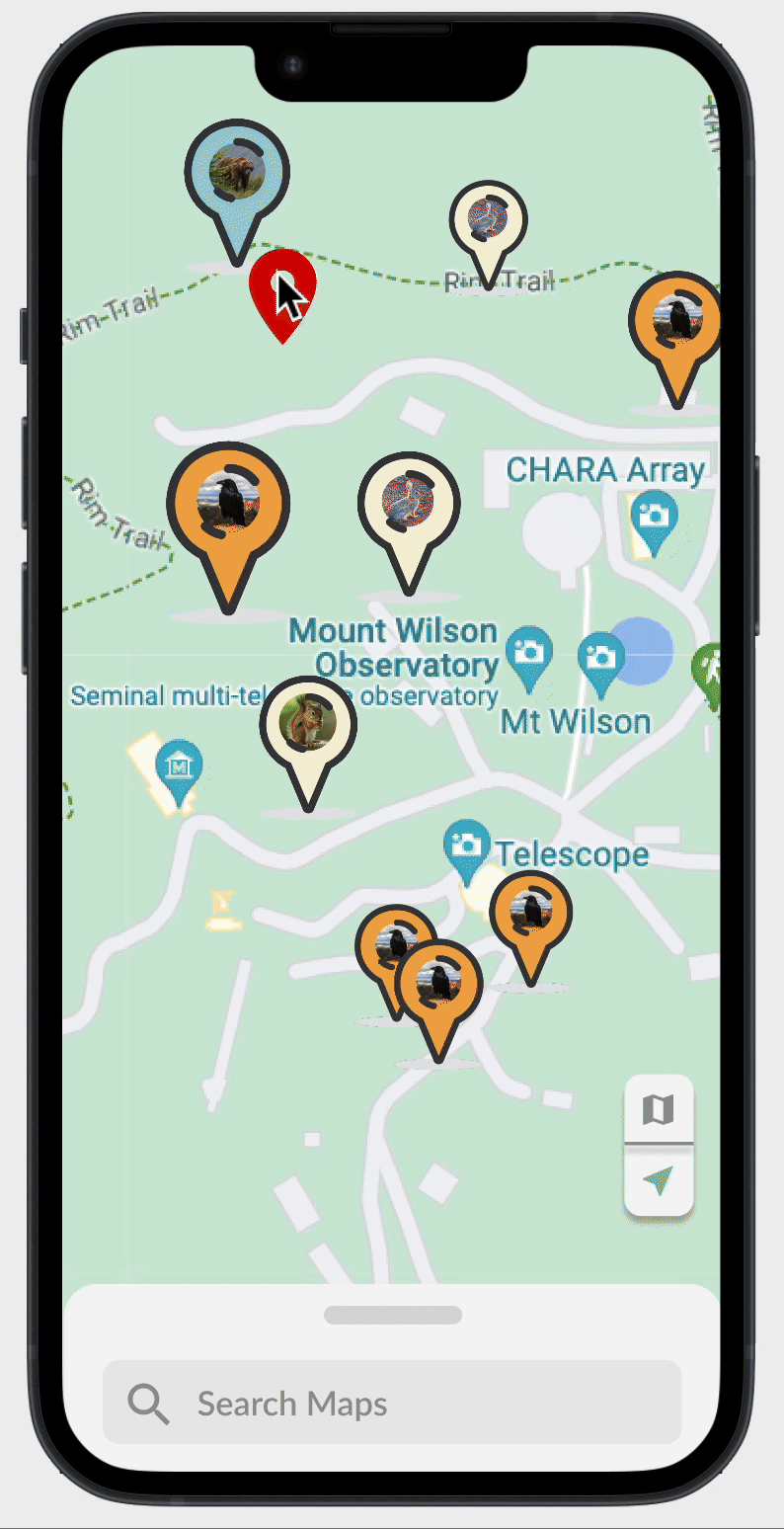
Explor Wildlife Map
Upload user's sighting to the live map. Discover where others have seen animals, join conversations, and plan user's next trail with wildlife hotspots in mind.

Wildlife Park
Every scanned animal becomes part of user's personal 3D park. The more user explore, the more user collection grows.
User Flow
.png)
High-Fidelity Prototype
Scanning and recognition experience
Users can snap a photo of a wild animal they encounter during a hike. The app uses image recognition to identify the species in real time, offering quick feedback and encouraging further exploration.
Exploring the social map
The interactive map displays wildlife sightings from all users in real time. Icons represent different animals, showing where they were spotted. Users can tap into sightings to learn more or plan routes based on wildlife activity.
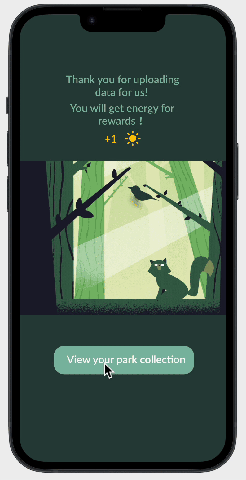
Add description to the database
After identification, users can contribute by adding a short description or notes about the sighting — behavior, time, location, or fun facts. This data enriches the community-driven wildlife database and boosts user engagement.
Animal discovery upload information
Tapping an animal icon on the map reveals sighting details—time, location, and notes from different users. Users can view contributor profiles, follow them, and build social connections around shared wildlife interests.
Viewing 3D Animal Park
Each recognized and uploaded animal is added to the user’s personal 3D Animal Park — a virtual collection space where users can interact with the animals they’ve “collected,” creating a sense of achievement and personalization.
Talk to animals in AR
Using AR, users can “talk” to the animals in their 3D park — triggering short animations or educational audio responses that bring the creatures to life in an engaging, playful way.


